When you buy through links on our site, we may earn an affiliate commission. As an Amazon Associate I earn from qualifying purchases.

Awesome Geography

The World’s Funniest Place Names

The World’s Funniest Place Names

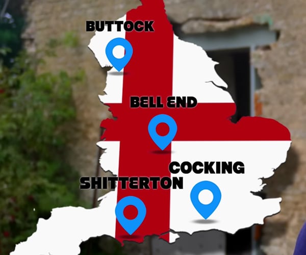
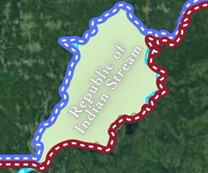
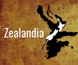
We’ve stopped at the Bong Recreational area in Wisconsin and driven through Dildo, Newfoundland, but many other places have funny names too. Language expert RobWords takes us on a virtual trip around the globe to introduce us to places with names like Dick’s Knob, Scratchy Bottom, and Fan y Big.

Geolocating Songs Based on Their Lyrics

Geolocating Songs Based on Their Lyrics

Song lyrics often refer to locations, but they rarely are specific and sometimes inaccurate. Jam2Go thought he’d nail down the exact places in songs, starting with the guy in the Plain White T’s Hey There Delilah, who mentions he’s 1000 miles away from Delilah. Then he travels to Ocean Avenue, Africa, Over the Rainbow, and Country Roads.

Advertisement

The Highpoints: The Tallest Point in Each State

The Highpoints: The Tallest Point in Each State

Artist Isaac Dushku loves maps so much that he goes by the nickname Lord of Maps. After making a Highest Mountains Print that shows the tallest mountains in each US state, he teamed up with his brothers Gideon and Alex to create a book that captures the same idea using cutout pages. The Highpoints has a lay-flat binding for easy coffee-table viewing.

How Florida Got So Weird

How Florida Got So Weird

Having lived in Orlando, we can confirm that Florida is, um… different. Wendover Productions looks at the history of the Sunshine State and how it got to be unlike any other place, with its manufactured communities, theme parks, and its population of runaways from other states, stoked by its beaches and low taxes.

America’s Weirdest Place Names

America’s Weirdest Place Names

We’ve driven through some places with weird names like Hell, Michigan and the Bong Recreation Area in Wisconsin. Lost in the Pond studied a map of America to find more strange place names, and explained the history of their unusual monikers. Though Newfoundland has them all beat.

How Runway Numbers Work

How Runway Numbers Work

Previously, CGP Grey explained the surprisingly simple numbering scheme for U.S. interstates. Now he’s back to teach us how the numbers on airport runways work. You’ll also learn how airports decide which way to run their runways and what the North Pole has to do with everything. Oh, and this is not a physics video.

Topo Trail Maps

Topo Trail Maps
Buy

Commemorate your adventures and travels with these outstanding wood artworks from Topo Trail Maps. Each one is custom-made by artist Trevor Crosta based on a trail you specify. They feature deep, 3-dimensional carvings of the terrain, and come in two National Parks designs, as well as a rectangular floating frame.

Advertisement

Wooblock Wooden Globe Model

Wooblock Wooden Globe Model

This 707-piece wooden globe model has a motor-drive mechanism that keeps it spinning. In addition to the rotating globe, a tiny, magnetic ship sails around its base to commemorate Magellan’s journey around the Earth. Each of its 81 continental puzzle pieces has pinholes so you can mark cities you’ve visited.

iLikeMaps City Map Pillows

iLikeMaps City Map Pillows
Buy

Montreal artist Olivier Gratton-Gagné is obsessed with maps. Olivier applied his coding and graphic design skills to data on OpenStreetMap, and his iLikeMaps project was born. Based on satellite imagery, each 18″x18″ pillow design is a contemporary work of art, appearing both abstract and detailed with identifiable avenues.

World Light

World Light

This unique piece of decor puts an illuminated world map on your wall. Created by Zero Degree, the World Light is a 3D cutout wood map by day and lights up with thousands of tiny dots at night, like cities in nighttime satellite imagery. It’s available in natural wood or white finishes, in traditional or geometric map designs.

4DMAPART

4DMAPART
Buy

4DMAPART creates eye-popping elevation map prints. Each image jumps right off the page thanks to an impressive depth illusion that combines light, shadow, color, and topographical data captured by the Shuttle Radar Topography Mission. They can be printed onto photo paper or metal. The U.S. geology map is our favorite.

The True Size of…

The True Size of…

When looking at a 2D map of the world, it’s really hard to understand how big countries really are. For instance, the U.S., Australia, and Europe are similarly sized. Developed by James Talmage and Damon Maneice, The True Size Of… lets you drag countries on top of each other to better visualize their relative sizes.

Advertisement

The World Ocean

The World Ocean

Technically, all of the world’s oceans are connected and therefore they’re a single, giant body of water. Still, geographers sliced them into sections and named them so we’d know roughly where we are. Minute Earth explains where the boundaries are located, and suggests a more logical way of breaking them up based on science.

Why Cities Exist

Why Cities Exist

Despite the crowds, costs, crime, and other drawbacks of big cities, people flock together in densely packed areas, leaving vast areas of the world undeveloped. Wendover Productions looks at the reasons that over 50% of the global population occupies just 1% of the land.

If Pangea Never Broke Apart

If Pangea Never Broke Apart

For those of you who were sleeping in class that day, before the earth broke into continents, about 1/3rd of our planet was covered with a landmass known as Pangea. What If attempts to deduce what life might be like if we could still drive from Chicago to Paris, and assuming that we actually evolved to become what we are.

Mapping Oceans with Rubber Ducks

Mapping Oceans with Rubber Ducks

In 1992, 12 containers fell off of a ship in the Pacific Ocean. Among the lost cargo – 29,000 rubber duckies. But those ducks would serve a greater purpose, helping oceanographers map currents based on where they washed ashore. Half as Interesting explains.

What Every State is Best and Worst At

What Every State is Best and Worst At

RealLifeLore pumps up, then quickly deflates every state in the U.S. with this look at what each state statistically does best and worst in the country. And here we thought Alaska would be a nice safe place to live.

The Island with Two Countries

The Island with Two Countries

If you think being governed by one nation has its challenges, imagine what it would be like if for half the year, we were ruled by one country, and the other half by another. That’s what you’d have to deal with if you lived on Pheasant Island. Half as Interesting explains.

The Republic of Indian Stream

The Republic of Indian Stream

Did you know that for a brief period of time, there was actually a small nation that sat between the U.S. and Canada along their Eastern border? Half as Interesting offers a brief history of the Republic of Indian Stream, why it existed, and what happened to it.

US Geography Weirdness

US Geography Weirdness

We’ve all gotten so used to seeing maps of the world in cylindrical and pseudo-cylindrical projections, that our sense of where things are placed and their sizes is pretty distorted compared to reality. RealLifeLore explains many misperceptions of our nation’s geography.

The Farthest Place from You

The Farthest Place from You

RealLifeLore ponders what is a fairly simple question to answer – what’s the farthest point away from you on Earth at this very moment? Our antipode is far off the coast of Perth, in the middle of the Indian Ocean. Find your opposite spot here.

What If There Was an 8th Continent?

What If There Was an 8th Continent?

AlternateHistoryHub teaches us that there’s actually already a place that could have qualified as another continent, though the one big problem is that the majority of Zealandia sits underwater. He then imagines what might have happened if it hadn’t been submerged.

Why All World Maps Are Wrong

Why All World Maps Are Wrong

“The surface of a sphere cannot be represented as a plane without some form of distortion.” That pretty much sums up the fact that there’s really no way to accurately represent the earth in flat maps, as Vox explains. After you stop saying “Winkel Tripel,” go play with this.

ADVERTISEMENT

Home | About | Suggest | Contact | Team | Links | Privacy | Disclosure
Advertise | Facebook | Twitter | Pinterest | Sites We Like

Awesome Stuff: The Awesomer | Cool Cars: 95Octane
Site Design & Content © 2008-2024 Awesomer Media / The Awesomer™