Google Maps: The Boneyard
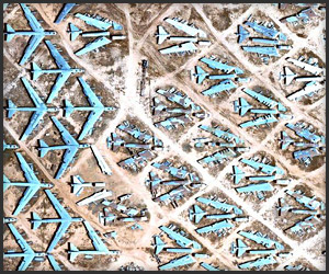
The Boneyard near Tucson, Arizona is where old military aircraft permanently bail out, and is viewable on Google Maps; there are over 4,000 planes spread out across 2,600 acres.
The Boneyard near Tucson, Arizona is where old military aircraft permanently bail out, and is viewable on Google Maps; there are over 4,000 planes spread out across 2,600 acres.
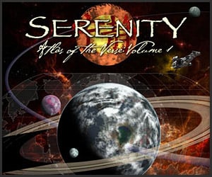
Firefly captains can learn the New Canaan run with the Atlas of the Verse: Volume One; the giant 12″x16″ book features 26 full-color pages and 11 planetary systems on 100 lb. paper.
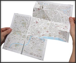
Technology continues to unfold even in the analog realm with The Zoomable Map; made out of an ancient material called paper, it zooms into London with a patented folding mechanism.

Because a big planet needs a big book: the limited edition Earth Atlas stands two feet tall by 18 inches wide, with 480 pages and 800 images; it’s “only” $4,800 before 1/1/2010.
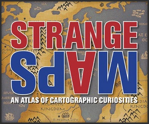
Based on the successful blog of the same name, Strange Maps is a fascinating mix of social commentary and cartographical creativity; it includes 138 graphics and spans 256 pages.
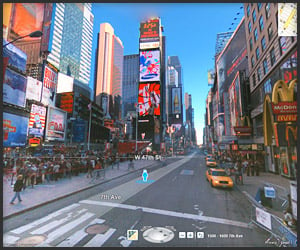
Microsoft introduces Photosynth to Bing Maps with its own version of street level view; we actually prefer it over Google, as it boasts higher quality images and feels much more 3D.
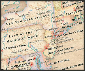
The Big Apple becomes New Yew Tree Village with the Atlas of True Names, a set of maps which translate the names of cities into English; our favorite? Stink Onion (Chicago).
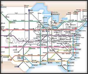
The US Interstate system gets reinterpreted in the style of the London Underground thanks to Cameron Booth; consistent line rules and color coding result in an amazingly readable map.
We like the free airport Wi-Fi, but Google Maps gets put to more practical (and healthy) uses: the Flu Shot Finder helps you track down seasonal and H1N1 flu shots in your neighborhood.
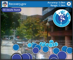
Augmented reality goes political with Sunlight Labs’ Recovery.gov and Layar mashup; it gives us a tangible idea of where the $787 billion in Uncle Sam’s pocket change has gone.
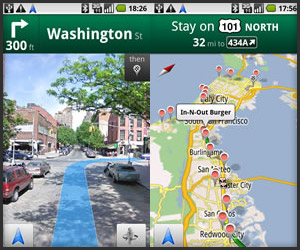
Google fires a huge shot across the bow of other GPS devices and apps with Google Maps Navigation; available only on Android 2.0, it includes 3D views, turn-by-turn navi and auto rerouting.
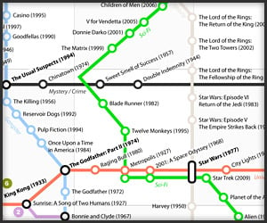
Looking as complicated as a New York subway map, this Best Movies Of All Time Map by David Honnorat uses IMDb’s Top 250 films of all time and diagrams them along genre lines.
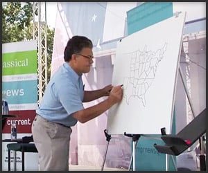
Setting political allegiances (or the lack thereof) aside, Senator Al Franken draws the US map from memory at the Minnesota State Fair; this should be required viewing for all politicians.

Short for “map projector,” Jinsun Park’s Maptor seems redundant with GPS-equipped phones; however, it’d be a godsend for group use such as search & rescue and tour guides.
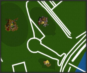
Oh, Italy, how far you’ve fallen: Rome gets redone as a giant Orc camp with this Warcraft 2-style map; it uses Cartagen, a mapping framework that can load GSS (geo style sheet) files.
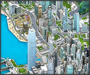
We liked the navigable map of Shanghai, but we were really waiting for a Hong Kong Pixel Map; the island of Triad mafias, colonial influences and urban vinyl is a feast for the eyes.
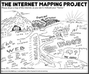
The name sounds academic, but Kevin Kelly’s Internet Mapping Project is more suited to cocktail napkins: it’s a collection of 60 hand-drawn maps of the Internet from TED attendees.
Seen at Google I/O, the Google Holodeck shows Street View at high speed; it gives viewers the illusion of motion, which is fun as long as the safety protocols don’t go offline.
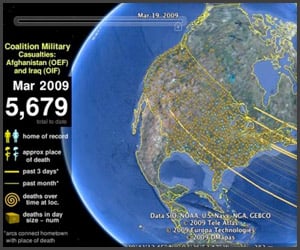
It’s Memorial Day in the US, so in honor of 5,700+ fallen servicemen and women in Iraq and Afghanistan, please visit Map the Fallen; it shows both their homes and places of passing.
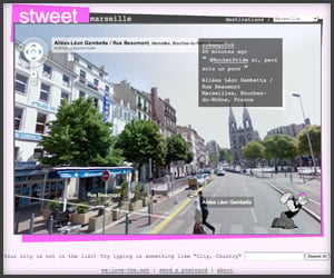
It has some stability issues, but we like how Stweet.com mashes up Twitter and Google Maps; it uses street views to lend even more of a voyeuristic quality to live tweets.
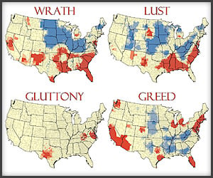
Kansas State University geographers have mapped out the Seven Deadly Sins across the United States, using information like fast food restaurants, poverty, crime and disease.
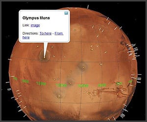
Google Earth 5.0 also comes with enhancements for the other (red) planet: Mars will get nearly-live imagery from the Odyssey and Reconnaisance Orbiter as well as 3D viewing.
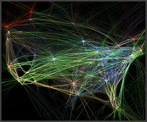
Air traffic has never looked so beautiful–or been so interactive: artist Aaron Koblin has created Google Maps of 205,000 flight paths on 8/12/08; they’re sortable by altitude, make and model.
Home | About | Suggest | Contact | Team | Links | Privacy | Disclosure
Advertise | Facebook | Twitter | Pinterest | Sites We Like
Awesome Stuff: The Awesomer | Cool Cars: 95Octane
Site Design & Content © 2008-2024 Awesomer Media / The Awesomer™